Biography
As an Environmental Specialist with a passion for sustainability, I bring over 14 years of experience working at the intersection of climate change, water resources, and community resilience in South Asia. With a foundation in hydrogeology and strong skills in data analytics, M&E, and GIS, I thrive on turning complex environmental data into actionable insights that help drive positive change. I’ve been fortunate to collaborate with diverse teams in government and NGOs like DASCOH, SRC, Water Relief, and Bangladesh’s Ministry of Land, contributing to projects that build climate-adaptive solutions and protect vulnerable communities. I’m eager to connect with like-minded professionals and continue growing my impact in the sustainable development space.
Download my resumé .
- Environment, Climate Change
- Hydrogeology, Water Management
- GIS, Remote Sensing, Mapping
- Monitoring & Evaluation, MEAL, MEL
- Data Science
Master of Science in Environmental Science, 2024
Jahangirnagar University
MSc. in Geology and Mining (Water & Environmental Management), 2012
University of Rajshahi
BSc. in Geology and Mining (Remote Sensing and GIS, Mapping, Geophysics, Hydrology & so on), 2011
University of Rajshahi
Post Graduate Diploma (PGD) in ICT (PGDICT), 2023
BKIICT, Dhaka
Graduated IPDET Core Course on Evaluation (World Bank Funded Scholarship), 2024
University of Bern, Switzerland
Multilevel Water Governance (Dutch OKP Scholarship), 2019
The Hague Academy for Local Governance, The Hague, Netherlands
International Water Law and the Law of Transboundary Aquifers (SDC Scholarship), 2019
University of Geneva, Switzerland
Faecal Sludge and Water Management in Rural Areas, 2021
Centre for Science and Environment (CSE), New Delhi, India
Geographic Information System (GIS), 2015
RUET
Surveying, 2022
Dhaka Polytechnic Institute, BTEB
Skills
5+ years of experience in web application development with strong proficiency in HTML, CSS, JavaScript, Bootstrap, PHP, and MySQL.
5+ years of experience using Python
8+ years of experience using ArcGIS
8+ years of experience of Data Solution, Analysis
7 years of experience of conducting data acquisition, surveying through KoBo Toolbox/ODK and relevant technologies
7 years of experience of using SQL & advance-excel
Experience
Responsibilities include:
- GIS and Remote sensing, Geospatial analysis
- Environmental Policy
- EIA, EA, EMP, SIA, SEA, ESIA, M&E
Responsibilities include:
- GIS and Remote sensing, Geospatial analysis
- Geodatabase, Land Use Information and Management Systems
- Conduct surveys, Data Analysis, Impact Assessment
- Monitoring and Evaluation
Responsibilities include:
- Conduct surveys using KoBo, ODK
- Monitoring and Evaluation
- Water policy, legal instruments
- Groundwater Monitoring, Hydrological investigation, analysis & Report
- GIS and Remote sensing
Publications
Accomplishments
Training & Short Courses I’ve accomplished
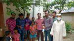
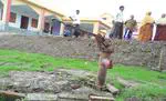
Projects


Recent Posts
1. Start with an instruction
Try making your instruction more specific. e.g: Suggest one name for a black horse.
2. Add some examples
It’s helpful to both show and tell the model what you want. Adding examples to your prompt can help communicate patterns or nuances. Try submitting this prompt which includes a couple examples.